Tokyo is the capital of Japan and the center of the “Greater Tokyo Area”, which has a population of 36 million, making it the most populous area in the world. Tokyo is often referred to and thought of as a city, but officially it is known as a “metropolitan prefecture”, which differs from a city. It consists of 23 Special Wards, which cover the area that was formerly the City of Tokyo before it merged and became the subsequent metropolitan prefecture in 1943. Tokyo has a lot of world-famous sights and offers a huge variety of activities, ranging from ultra modern to traditional.
Tokyo Rundown: A Quick Look
Photo by: Luke Ma – Beautiful Tokyo – Sony A7R
Map of Tokyo
Tokyo Rundown: Areas, Neighborhoods, and Places
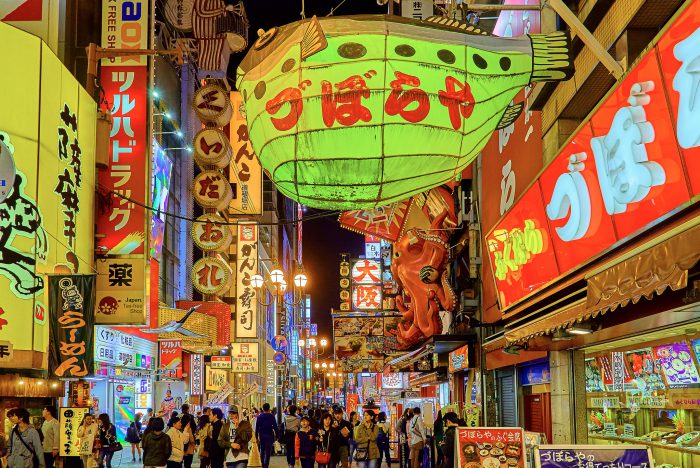
Photo by: Yoshikazu TAKADA – Sculpture of SpiderAsakusa
Location: Find on Google Maps
This district in Taitō ward is famous for the Sensō-ji, a Buddhist temple dedicated to the goddess Kannon and it’s Tokyo’s oldest geisha district. There are several other temples in Asakusa, as well as various festivals. The largest and most popular is the Sanja Matsuri in May, when roads are closed from dawn until late in the evening. Next to the Sensō-ji temple grounds is a small amusement park called Hanayashiki, which claims to be the oldest amusement park in Japan. The neighborhood theaters specialize in showing classic Japanese films, as many of the tourists are elderly Japanese.
Aoyama
Location: Find on Google Maps
Along with Shibuya and Harajuku, this is one of the most popular entertainment and shopping areas for young people in Tokyo. It is well known for its fashion houses, restaurants, and shopping. Chichibunomiya Rugby Stadium is in the North part of Aoyama. Aoyama was named after a sumurai, Aoyama Tadanari, who served the Tokugawa Shogun. Aoyama Tadanari had his residence in the area.
Akihabara
Location: Find on Google Maps
This famous district in the Chiyoda ward gained the nickname Akihabara “Electric Town” shortly after World War II for being a major shopping center for household electronic goods and the post-war black market. Nowadays, Akihabara is considered by many to be an otaku cultural center and a shopping district for computer goods, video games, anime, and manga. Icons from popular anime and manga are displayed prominently on the shops in the area, and numerous maid cafés are found throughout the district.
Ebisu
Location: Find on Google Maps
Ebisu is a neighborhood in Shibuya Ward, near Roppongi and central Shibuya. Together with the trendy neighboring communities of Daikanyama and Hiroo, it has boutiques, vintage stores and patisseries all within easy walking distance from Ebisu station. Therefore, Ebisu is one of the most expensive places to live in central Tokyo area. Ebisu’s main tourist attraction is centered on the Yebisu Garden Place and the Westin Hotel area. Accessible from the East Exit of Ebisu Station via the Yebisu Skywalk covered moving walkway, it includes the headquarters of Sapporo Breweries, The Beer Museum Yebisu and the Tokyo Metropolitan Museum of Photography
Ginza
Location: Find on Google Maps
Ginza is known as an upscale area of Tokyo with numerous department stores, boutiques, restaurants and coffeehouses. Ginza is recognized as one of the most luxurious shopping districts in the world. Many leading fashion houses’ flagship stores are located here, being also recognized as having the highest concentration of western shops in Tokyo. It is one of two locations, in Tokyo, considered by Chevalier to be the best location for a luxury-goods store. Prominent are Chanel, Carolina Herrera, Dior, Gucci, and Louis Vuitton. Flagship electronic retail stores like the Sony showroom and the Apple Store are also here. Each Saturday and Sunday, from 12:00 noon until 5:00 pm, the main street through Ginza is closed off to road traffic, allowing people to walk freely.
Harajuku
Location: Find on Google Maps
Harajuku is known internationally as a center of Japanese youth culture and fashion. The area spreads from Harajuku Station to Omotesando. In popular reference Harajuku also encompasses many smaller backstreets such as Takeshita Street and Cat Street spreading between Sendagaya in the north to Shibuya in the south. Shopping and dining options include many small, youth oriented, independent boutiques and cafés, but the neighborhood also attracts many larger international chain stores with high-end luxury merchandisers extensively represented along Omotesando. Harajuku Station also acts as gateway to nearby attractions such as the Meiji Shrine, Yoyogi Park and Yoyogi National Gymnasium, making Harajuku and its environs one of the most popular destinations in Tokyo for both domestic and international tourists.
Ikebukuro
Location: Find on Google Maps
A commercial and entertainment district in Toshima Ward. Ikebukuro Station is the second busiest station in Japan, second only to Shinjuku Station. It’s famous for the very large Seibu and Tōbu department stores, which are located around the station.
Imperial palace
Location: Find on Google Maps
The Tokyo Imperial Palace (皇居 Kōkyo, literally, “Imperial Residence”) is the main residence of the Emperor of Japan. It is a large park-like area located in the Chiyoda area of Tokyo close to Tokyo Station and contains several buildings including the main palace, the private residences of the imperial family, an archive, museum and administrative offices. The present Imperial Palace encompasses the retrenchments of the former Edo Castle. Except for Imperial Household Agency and the East Gardens, the palace is generally closed to the public.
Kabuki-cho
Location: Find on Google Maps
Kabukichō is an entertainment and red-light district in Shinjuku Ward. It is the location of many host and hostess clubs, love hotels, shops, restaurants, and nightclubs, and is often called the “Sleepless Town”. The district’s name comes from late-1940s plans to build a kabuki theater: although the theater was never built, the name stuck. The area has many movie theaters, and is located near Shinjuku Station, Seibu Shinjuku Station.
Marunoichi
Location: Find on Google Maps
A commercial district of Tokyo located in Chiyoda between Tokyo Station and the Imperial Palace. The name, meaning “inside the circle”, derives from its location within the palace’s outer moat. It is also Tokyo’s financial district. The country’s three largest banks, as well as several big Japanese companies are headquartered there.
Nakano Broadway
Location: Find on Google Maps
Nakano Broadway is a building complex in Nakano Ward with extraordinary shopping facilities. Regular goods like clothes and food but in a great variety of choice are sold in the first floor and the connected Shotengai (Japanese commercial district street), the upper floors are popular for hobby and Otaku related goods. This makes Nakano Broadway a smaller but good alternative to famous Akihabara district among hobby enthusiasts.
Nippon Budokan
Location: Find on Google Maps
The Nippon Budokan, often shortened to simply Budokan, is an indoor arena in central Tokyo, where many “Live at the Budokan” albums from world-famous artists were recorded, including those of Bob Dylan, Cheap Trick and Ozzy Osbourne. The Nippon Budokan, however, was originally built for the judo competition in the 1964 Summer Olympics, hence its name, rendered in English as Martial Arts Hall. Though it still functions as a venue for big musical events, its primary purpose is for Japanese martial arts. The national championships of the different branches (judo, kendo, karate, aikido, shorinji kempo, kyūdō, naginata, etc.) are held annually at the Budokan.
Odaiba
Location: Find on Google Maps
A large artificial island in Tokyo Bay, Japan, across the Rainbow Bridge from central Tokyo. It was initially built for defensive purposes in the 1850s, dramatically expanded during the late 20th century as a seaport district, and has developed since the 1990s as a major commercial, residential and leisure area. The seashore is accessible, and not blocked by industry or harbor areas. Odaiba has One of two beaches in urban Tokyo. Today’s Odaiba is a popular shopping and sightseeing destination for Tokyoites and tourists alike. Major attractions include: the Palette Town (with Leisure Land and shopping facilities), Fuji Television Building, Tokyo Big Sight Exhibition Center, Various Shopping Centers, Musuem of Maritime Science and more.
Omotesando
Location: Find on Google Maps
A Zelkova tree-lined avenue (located in Shibuya and Minato Ward) and an upscale shopping area featuring several international brand outlets. Omotesandō is known as one of the foremost ‘architectural showcase’ streets in the world, featuring a multitude of fashion flagship stores within a short distance of each other. It is one of two locations, in Tokyo, considered by Chevalier to be the best location for a luxury-goods store. Its latest development, Omotesandō Hills, opened in 2006. Omotesandō’s side streets known as Ura-Harajuku, feature a range of smaller cafes, bars, and restaurants, as well as boutique stores.
Rainbow Bridge
Location: Find on Google Maps
The Rainbow Bridge is a suspension bridge crossing northern Tokyo Bay between Shibaura Pier and the Odaiba waterfront Minato Ward. Construction started in 1987 and was completed in 1993. The bridge is 798 meters (2,618 ft) long with a main span of 580 meters (1,903 ft). The bridge has two separate walkways on the north and south sides of the lower deck; the north side offers views of the inner Tokyo harbor and Tokyo Tower, while the south side offers views of Tokyo Bay and occasionally Mount Fuji. The walkways may only be used during certain hours (9 am to 9 pm in the summer; 10 am to 6 pm in the winter, access to the walkways close 30 minutes before closing time).
Roppongi
Location: Find on Google Maps
This district of Minato Ward is famous as home to the rich Roppongi Hills area and an active night club scene. Many foreign embassies are located in Roppongi, and the night life is popular with locals and foreigners alike. The area features numerous bars, nightclubs, strip clubs, restaurants, hostess clubs, cabarets, and other forms of entertainment. Among the expatriate community, the area tends to be favored by business people, students, and off-duty US military personnel. Overall, the neighborhood caters to a younger crowd.
Shibuya
Location: Find on Google Maps
Shibuya is one of the 23 wards of Tokyo but also often refers to the area surrounding Shibuya Station, one of Tokyo’s busiest railway station. This area is known as one of the fashion centers of Japan, particularly for young people, and as a major nightlife area. Shibuya is known for its scramble crossing. It is located in front of the Shibuya Station Hachikō exit and stops vehicles in all directions to allow pedestrians to inundate the entire intersection. The statue of Hachikō, a dog, between the station and the intersection, is a common meeting place and almost always crowded. Shibuya Crossing is often featured in movies and television shows which take place in Tokyo and became a world-famous scenery.
Shinjuku
Location: Find on Google Maps
Shinjuku is one of the 23 wards of Tokyo. It is a major commercial and administrative centre, housing the busiest train station in the world (Shinjuku Station) and the Tokyo Metropolitan Government Building, the administration centre for the government of Tokyo. “Shinjuku” is often popularly understood to mean the entire area surrounding Shinjuku Station. Many companies have their headquarters or Tokyo offices in Shinjuku and it’s a major urban transit hub. Shinjuku Station sees an estimated 3.64 million passengers pass through each day, making it the busiest station in the world. It houses interchanges to three subway lines and three privately owned commuter lines, as well as several JR lines.
Tokyo Dome & Tokyo Dome City
Location: Find on Google Maps
This 55,000-seat baseball stadium located in Bunkyo Ward was built in 1988 and is the home field of the Yomiuri Giants baseball team, and has also hosted basketball, American football and association football games, as well as puroresu (pro-wrestling) matches, mixed martial arts events, kickboxing events, monster truck races, and music concerts.
Tokyo Dome is part of a greater entertainment complex known as Tokyo Dome City, built of the grounds of the former Tokyo Koishikawa arsenal. Tokyo Dome City includes an amusement park and Tokyo Dome City Attractions (formerly Kōrakuen Grounds). This amusement park occupies the former Korakuen Stadium site and includes a roller coaster named Thunder Dolphin and a hubless Ferris wheel. The grounds also have an onsen called Spa LaQua, various shops, restaurants, video game centers, the largest JRA WINS horse race betting complex in Tokyo, and Oft Korakuen, which caters to rural horse races.
Tokyo Sky Tree
Location: Find on Google Maps
Tokyo Sky Tree is a recently built broadcasting, restaurant, and observation tower in Sumida ward. It became the tallest structure in Japan in 2010 and reached its full height of 634.0 metres (2,080 ft) in March 2011, making it the tallest tower in the world and the second tallest structure in the world. At the ground and also next to Sky Tree a building complex named “Solamachi” was built. It holds various dining and shopping facilities. It was established together with Sky Tree with the idea of “connecting Japan to the World”. There are also the Sumida Aquarium, the Tenku planetarium (no English provided) and in the multiple small green spaces and terraces found across the complex.
Tokyo Station
Location: Find on Google Maps
Tokyo Station is the main intercity rail terminal in Tokyo. It is the busiest station in Japan in terms of number of trains per day (over 3,000), and the fifth-busiest in Eastern Japan in terms of passenger throughput. The main station consists of 10 island platforms serving 20 tracks, raised above street level running in a north-south direction. The main concourse runs east-west below the platforms. The whole complex is linked by an extensive system of underground passageways which merge with surrounding commercial buildings and shopping centers.
Tokyo Tower
Location: Find on Google Maps
Tokyo’s most famous tower located in the Shiba-koen district of Minato, built in 1958 for communication and observation. The tower’s main sources of revenue are tourism and antenna leasing. The tower acts as a support structure for an antenna. Originally intended for television broadcasting, radio antennas were installed in 1961, but the tower is now used to broadcast signals for Japanese media outlets such as NHK, TBS and Fuji TV. Located in the base of the tower is a 4-story building known as FootTown. The first floor includes the Aquarium Gallery, a reception hall, the 400-person-capacity “Tower Restaurant,” a FamilyMart convenience store and a souvenir shop.
Ueno Park
Location: Find on Google Maps
Ueno Park is the home of a number of major museums and 8,800 trees. It also has many hundred cherry trees, which makes it a popular location for hanami (annual cherry blossom watching). In recent times the park and its attractions have drawn over ten million visitors a year, making it Japan’s most popular city park. Amongst the country’s first public parks, it was founded following the western example as part of the borrowing and assimilation of international practices that characterizes the early Meiji period.
Yoyogi Park
Location: Find on Google Maps
If you want to experience a slice of nature and peaceful atmosphere in the middle of Tokyo, Yoyogi Park is the right choice. Due to it’s mere size and spacious areas this Park is a proper location for a wide range of activities. Yoyogi Park is one the largest parks in Tokyo and located adjacent to Harajuku Station and Meiji Shrine in Shibuya.
Meji Shrine:
Meji shrine is located directly next to the Park in a forest that covers an area of 700,000 square-meters (about 175 acres). This area is covered by an evergreen forest that consists of 120,000 trees of 365 different species, which were donated by people from all parts of Japan when the shrine was established. The forest is visited by many as a recreation and relaxation area in the center of Tokyo. The Meiji Shrine is dedicated to the deified spirits of Emperor Meiji and his wife, Empress Shōken.
Tags: Greater Tokyo Area, Nakano Broadway, Tokyo Imperial Palace
Categorised in: Akasaka, Akihabara, Aoyama, Asakusa, Ebisu, Ginza, Harajuku, Hibiya, Ikebukuro, Marunouchi, Nihombashi, Odaiba, Roppongi, Ryogoku, Shibuya, Shinagawa, Shinjuku, Shiodome, Tokyo, Travel In Japan, Tsukiji, Ueno
This post was written by Mathew Ryan
Tokyo is the capital of Japan and the center of the “Greater Tokyo Area”, which has a population of 36 million, making it the most populous area in the world. Tokyo is often referred to and thought of as a city, but officially it is known as a “metropolitan prefecture”, which differs from a city. It consists of 23 Special Wards, which cover the area that was formerly the City of Tokyo before it merged and became the subsequent metropolitan prefecture in 1943. Tokyo has a lot of world-famous sights and offers a huge variety of activities, ranging from ultra modern to traditional.
Tokyo Rundown: A Quick Look
Photo by: Luke Ma – Beautiful Tokyo – Sony A7R
Map of Tokyo
Tokyo Rundown: Areas, Neighborhoods, and Places
Photo by: Yoshikazu TAKADA – Sculpture of SpiderAsakusa
Location: Find on Google Maps
This district in Taitō ward is famous for the Sensō-ji, a Buddhist temple dedicated to the goddess Kannon and it’s Tokyo’s oldest geisha district. There are several other temples in Asakusa, as well as various festivals. The largest and most popular is the Sanja Matsuri in May, when roads are closed from dawn until late in the evening. Next to the Sensō-ji temple grounds is a small amusement park called Hanayashiki, which claims to be the oldest amusement park in Japan. The neighborhood theaters specialize in showing classic Japanese films, as many of the tourists are elderly Japanese.
Aoyama
Location: Find on Google Maps
Along with Shibuya and Harajuku, this is one of the most popular entertainment and shopping areas for young people in Tokyo. It is well known for its fashion houses, restaurants, and shopping. Chichibunomiya Rugby Stadium is in the North part of Aoyama. Aoyama was named after a sumurai, Aoyama Tadanari, who served the Tokugawa Shogun. Aoyama Tadanari had his residence in the area.
Akihabara
Location: Find on Google Maps
This famous district in the Chiyoda ward gained the nickname Akihabara “Electric Town” shortly after World War II for being a major shopping center for household electronic goods and the post-war black market. Nowadays, Akihabara is considered by many to be an otaku cultural center and a shopping district for computer goods, video games, anime, and manga. Icons from popular anime and manga are displayed prominently on the shops in the area, and numerous maid cafés are found throughout the district.
Ebisu
Location: Find on Google Maps
Ebisu is a neighborhood in Shibuya Ward, near Roppongi and central Shibuya. Together with the trendy neighboring communities of Daikanyama and Hiroo, it has boutiques, vintage stores and patisseries all within easy walking distance from Ebisu station. Therefore, Ebisu is one of the most expensive places to live in central Tokyo area. Ebisu’s main tourist attraction is centered on the Yebisu Garden Place and the Westin Hotel area. Accessible from the East Exit of Ebisu Station via the Yebisu Skywalk covered moving walkway, it includes the headquarters of Sapporo Breweries, The Beer Museum Yebisu and the Tokyo Metropolitan Museum of Photography
Ginza
Location: Find on Google Maps
Ginza is known as an upscale area of Tokyo with numerous department stores, boutiques, restaurants and coffeehouses. Ginza is recognized as one of the most luxurious shopping districts in the world. Many leading fashion houses’ flagship stores are located here, being also recognized as having the highest concentration of western shops in Tokyo. It is one of two locations, in Tokyo, considered by Chevalier to be the best location for a luxury-goods store. Prominent are Chanel, Carolina Herrera, Dior, Gucci, and Louis Vuitton. Flagship electronic retail stores like the Sony showroom and the Apple Store are also here. Each Saturday and Sunday, from 12:00 noon until 5:00 pm, the main street through Ginza is closed off to road traffic, allowing people to walk freely.
Harajuku
Location: Find on Google Maps
Harajuku is known internationally as a center of Japanese youth culture and fashion. The area spreads from Harajuku Station to Omotesando. In popular reference Harajuku also encompasses many smaller backstreets such as Takeshita Street and Cat Street spreading between Sendagaya in the north to Shibuya in the south. Shopping and dining options include many small, youth oriented, independent boutiques and cafés, but the neighborhood also attracts many larger international chain stores with high-end luxury merchandisers extensively represented along Omotesando. Harajuku Station also acts as gateway to nearby attractions such as the Meiji Shrine, Yoyogi Park and Yoyogi National Gymnasium, making Harajuku and its environs one of the most popular destinations in Tokyo for both domestic and international tourists.
Ikebukuro
Location: Find on Google Maps
A commercial and entertainment district in Toshima Ward. Ikebukuro Station is the second busiest station in Japan, second only to Shinjuku Station. It’s famous for the very large Seibu and Tōbu department stores, which are located around the station.
Imperial palace
Location: Find on Google Maps
The Tokyo Imperial Palace (皇居 Kōkyo, literally, “Imperial Residence”) is the main residence of the Emperor of Japan. It is a large park-like area located in the Chiyoda area of Tokyo close to Tokyo Station and contains several buildings including the main palace, the private residences of the imperial family, an archive, museum and administrative offices. The present Imperial Palace encompasses the retrenchments of the former Edo Castle. Except for Imperial Household Agency and the East Gardens, the palace is generally closed to the public.
Kabuki-cho
Location: Find on Google Maps
Kabukichō is an entertainment and red-light district in Shinjuku Ward. It is the location of many host and hostess clubs, love hotels, shops, restaurants, and nightclubs, and is often called the “Sleepless Town”. The district’s name comes from late-1940s plans to build a kabuki theater: although the theater was never built, the name stuck. The area has many movie theaters, and is located near Shinjuku Station, Seibu Shinjuku Station.
Marunoichi
Location: Find on Google Maps
A commercial district of Tokyo located in Chiyoda between Tokyo Station and the Imperial Palace. The name, meaning “inside the circle”, derives from its location within the palace’s outer moat. It is also Tokyo’s financial district. The country’s three largest banks, as well as several big Japanese companies are headquartered there.
Nakano Broadway
Location: Find on Google Maps
Nakano Broadway is a building complex in Nakano Ward with extraordinary shopping facilities. Regular goods like clothes and food but in a great variety of choice are sold in the first floor and the connected Shotengai (Japanese commercial district street), the upper floors are popular for hobby and Otaku related goods. This makes Nakano Broadway a smaller but good alternative to famous Akihabara district among hobby enthusiasts.
Nippon Budokan
Location: Find on Google Maps
The Nippon Budokan, often shortened to simply Budokan, is an indoor arena in central Tokyo, where many “Live at the Budokan” albums from world-famous artists were recorded, including those of Bob Dylan, Cheap Trick and Ozzy Osbourne. The Nippon Budokan, however, was originally built for the judo competition in the 1964 Summer Olympics, hence its name, rendered in English as Martial Arts Hall. Though it still functions as a venue for big musical events, its primary purpose is for Japanese martial arts. The national championships of the different branches (judo, kendo, karate, aikido, shorinji kempo, kyūdō, naginata, etc.) are held annually at the Budokan.
Odaiba
Location: Find on Google Maps
A large artificial island in Tokyo Bay, Japan, across the Rainbow Bridge from central Tokyo. It was initially built for defensive purposes in the 1850s, dramatically expanded during the late 20th century as a seaport district, and has developed since the 1990s as a major commercial, residential and leisure area. The seashore is accessible, and not blocked by industry or harbor areas. Odaiba has One of two beaches in urban Tokyo. Today’s Odaiba is a popular shopping and sightseeing destination for Tokyoites and tourists alike. Major attractions include: the Palette Town (with Leisure Land and shopping facilities), Fuji Television Building, Tokyo Big Sight Exhibition Center, Various Shopping Centers, Musuem of Maritime Science and more.
Odaiba
Location: Find on Google Maps
A large artificial island in Tokyo Bay, Japan, across the Rainbow Bridge from central Tokyo. It was initially built for defensive purposes in the 1850s, dramatically expanded during the late 20th century as a seaport district, and has developed since the 1990s as a major commercial, residential and leisure area. The seashore is accessible, and not blocked by industry or harbor areas. Odaiba has One of two beaches in urban Tokyo. Today’s Odaiba is a popular shopping and sightseeing destination for Tokyoites and tourists alike. Major attractions include: the Palette Town (with Leisure Land and shopping facilities), Fuji Television Building, Tokyo Big Sight Exhibition Center, Various Shopping Centers, Musuem of Maritime Science and more.
Omotesando
Location: Find on Google Maps
A Zelkova tree-lined avenue (located in Shibuya and Minato Ward) and an upscale shopping area featuring several international brand outlets. Omotesandō is known as one of the foremost ‘architectural showcase’ streets in the world, featuring a multitude of fashion flagship stores within a short distance of each other. It is one of two locations, in Tokyo, considered by Chevalier to be the best location for a luxury-goods store. Its latest development, Omotesandō Hills, opened in 2006. Omotesandō’s side streets known as Ura-Harajuku, feature a range of smaller cafes, bars, and restaurants, as well as boutique stores.
Rainbow Bridge
Location: Find on Google Maps
The Rainbow Bridge is a suspension bridge crossing northern Tokyo Bay between Shibaura Pier and the Odaiba waterfront Minato Ward. Construction started in 1987 and was completed in 1993. The bridge is 798 meters (2,618 ft) long with a main span of 580 meters (1,903 ft). The bridge has two separate walkways on the north and south sides of the lower deck; the north side offers views of the inner Tokyo harbor and Tokyo Tower, while the south side offers views of Tokyo Bay and occasionally Mount Fuji. The walkways may only be used during certain hours (9 am to 9 pm in the summer; 10 am to 6 pm in the winter, access to the walkways close 30 minutes before closing time).
Roppongi
Location: Find on Google Maps
This district of Minato Ward is famous as home to the rich Roppongi Hills area and an active night club scene. Many foreign embassies are located in Roppongi, and the night life is popular with locals and foreigners alike. The area features numerous bars, nightclubs, strip clubs, restaurants, hostess clubs, cabarets, and other forms of entertainment. Among the expatriate community, the area tends to be favored by business people, students, and off-duty US military personnel. Overall, the neighborhood caters to a younger crowd.
Shibuya
Location: Find on Google Maps
Shibuya is one of the 23 wards of Tokyo but also often refers to the area surrounding Shibuya Station, one of Tokyo’s busiest railway station. This area is known as one of the fashion centers of Japan, particularly for young people, and as a major nightlife area. Shibuya is known for its scramble crossing. It is located in front of the Shibuya Station Hachikō exit and stops vehicles in all directions to allow pedestrians to inundate the entire intersection. The statue of Hachikō, a dog, between the station and the intersection, is a common meeting place and almost always crowded. Shibuya Crossing is often featured in movies and television shows which take place in Tokyo and became a world-famous scenery.
Shinjuku
Location: Find on Google Maps
Shinjuku is one of the 23 wards of Tokyo. It is a major commercial and administrative centre, housing the busiest train station in the world (Shinjuku Station) and the Tokyo Metropolitan Government Building, the administration centre for the government of Tokyo. “Shinjuku” is often popularly understood to mean the entire area surrounding Shinjuku Station. Many companies have their headquarters or Tokyo offices in Shinjuku and it’s a major urban transit hub. Shinjuku Station sees an estimated 3.64 million passengers pass through each day, making it the busiest station in the world. It houses interchanges to three subway lines and three privately owned commuter lines, as well as several JR lines.
Tokyo Dome & Tokyo Dome City
Location: Find on Google Maps
This 55,000-seat baseball stadium located in Bunkyo Ward was built in 1988 and is the home field of the Yomiuri Giants baseball team, and has also hosted basketball, American football and association football games, as well as puroresu (pro-wrestling) matches, mixed martial arts events, kickboxing events, monster truck races, and music concerts.
Tokyo Dome is part of a greater entertainment complex known as Tokyo Dome City, built of the grounds of the former Tokyo Koishikawa arsenal. Tokyo Dome City includes an amusement park and Tokyo Dome City Attractions (formerly Kōrakuen Grounds). This amusement park occupies the former Korakuen Stadium site and includes a roller coaster named Thunder Dolphin and a hubless Ferris wheel. The grounds also have an onsen called Spa LaQua, various shops, restaurants, video game centers, the largest JRA WINS horse race betting complex in Tokyo, and Oft Korakuen, which caters to rural horse races.
Tokyo Sky Tree
Location: Find on Google Maps
Tokyo Sky Tree is a recently built broadcasting, restaurant, and observation tower in Sumida ward. It became the tallest structure in Japan in 2010 and reached its full height of 634.0 metres (2,080 ft) in March 2011, making it the tallest tower in the world and the second tallest structure in the world. At the ground and also next to Sky Tree a building complex named “Solamachi” was built. It holds various dining and shopping facilities. It was established together with Sky Tree with the idea of “connecting Japan to the World”. There are also the Sumida Aquarium, the Tenku planetarium (no English provided) and in the multiple small green spaces and terraces found across the complex.
Tokyo Station
Location: Find on Google Maps
Tokyo Station is the main intercity rail terminal in Tokyo. It is the busiest station in Japan in terms of number of trains per day (over 3,000), and the fifth-busiest in Eastern Japan in terms of passenger throughput. The main station consists of 10 island platforms serving 20 tracks, raised above street level running in a north-south direction. The main concourse runs east-west below the platforms. The whole complex is linked by an extensive system of underground passageways which merge with surrounding commercial buildings and shopping centers.
Tokyo Tower
Location: Find on Google Maps
Tokyo’s most famous tower located in the Shiba-koen district of Minato, built in 1958 for communication and observation. The tower’s main sources of revenue are tourism and antenna leasing. The tower acts as a support structure for an antenna. Originally intended for television broadcasting, radio antennas were installed in 1961, but the tower is now used to broadcast signals for Japanese media outlets such as NHK, TBS and Fuji TV. Located in the base of the tower is a 4-story building known as FootTown. The first floor includes the Aquarium Gallery, a reception hall, the 400-person-capacity “Tower Restaurant,” a FamilyMart convenience store and a souvenir shop.
Ueno Park
Location: Find on Google Maps
Ueno Park is the home of a number of major museums and 8,800 trees. It also has many hundred cherry trees, which makes it a popular location for hanami (annual cherry blossom watching). In recent times the park and its attractions have drawn over ten million visitors a year, making it Japan’s most popular city park. Amongst the country’s first public parks, it was founded following the western example as part of the borrowing and assimilation of international practices that characterizes the early Meiji period.
Yoyogi Park
Location: Find on Google Maps
If you want to experience a slice of nature and peaceful atmosphere in the middle of Tokyo, Yoyogi Park is the right choice. Due to it’s mere size and spacious areas this Park is a proper location for a wide range of activities. Yoyogi Park is one the largest parks in Tokyo and located adjacent to Harajuku Station and Meiji Shrine in Shibuya.
Meji Shrine:
Meji shrine is located directly next to the Park in a forest that covers an area of 700,000 square-meters (about 175 acres). This area is covered by an evergreen forest that consists of 120,000 trees of 365 different species, which were donated by people from all parts of Japan when the shrine was established. The forest is visited by many as a recreation and relaxation area in the center of Tokyo. The Meiji Shrine is dedicated to the deified spirits of Emperor Meiji and his wife, Empress Shōken.
Tags: Greater Tokyo Area, Nakano Broadway, Tokyo Imperial Palace
Categorised in: Akasaka, Akihabara, Aoyama, Asakusa, Ebisu, Ginza, Harajuku, Hibiya, Ikebukuro, Marunouchi, Nihombashi, Odaiba, Roppongi, Ryogoku, Shibuya, Shinagawa, Shinjuku, Shiodome, Tokyo, Travel In Japan, Tsukiji, Ueno
This post was written by Mathew Ryan